
XXI IGCP Technical Conference 13-14.XI Warsaw - thank you for visiting our booth!
AI POWERED DATA & PROCESSES
DIGITIZATION FOR
BROWNFIELD PLANTS
PRODUCTS & SERVICES
Affordable first step toward building a digital twin
TELECYFRO
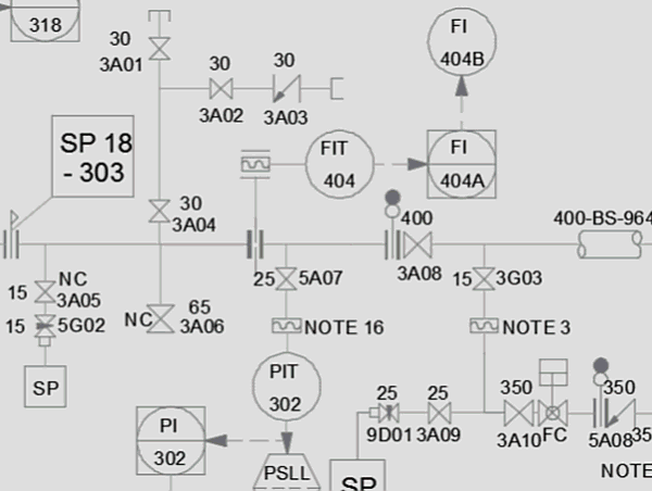
Telecyfro Explorer is a low-cost, lightweight yet highly effective browser for production maintenance personnel at chemical plants, power plants or mines. It is intended to quickly find the needed information in digitized technical documentation. It allows finding equipment, instruments, pipelines, cables, terminals, etc. based on their TAGs as well as searching for any other text in tens of thousands of pages of documentation. Application handles followig document types: P&IDs, loop diagrams, electric diagrams, mechanical diagrams and other. Integration with CADMATIC eShare allows further development of the digital twin without having to perform costly data conversions between systems.
Key features:
-
Search for documents by TAG, metadata, text
-
Search for related documents directly from a drawing
-
Search for documents on a plant floor plan
-
Search for textual patterns
-
Two way integration with CADMATIC eShare
Benefits:
-
Operational benefits in weeks not months or years
-
Reduced cost of maintenance processes
-
Improved preservation of technical knowledge
-
Protection against damage or loss of documents
-
Quick return on investment

DIGITIZATION OF TECHNICAL DOCUMENTATION
19E provides a full range of specialized, AI based services for the digitization of engineering documentation: from scanning, through enrichment (OCR+ metadata + TAGs) to comprehensive digitization of P&ID and accompanying documents (e.g. isometric drawings, loop diagrams, electrical schematics), to import into customer's data management systems (e.g. .DMS, CAD).

3D DIGITIZATION
Creation of 3D models (Digital Twin) of industry plants (chemical, oil&gas, power generation) from LIDAR point clouds and design documentation.

GEOSPATIAL/UTILITIES
Digitization of cadastral documents, base map source materials, utilities network documentation (power/water/telecom). Scanning, OCR, metadata extraction, map/model creation.
INDUSTRIES SERVED
Petrochemical plants

Energy
generation

Mining
industry


Pilot project
Scope:
-
Scanning of a sample documentation (0.5-1mb; A4-A0)
-
Plant logical model proposal
-
Digitization of scanned data (metadata + OCR)
-
Inventory of the entire archive
-
Delivery, installation and configuration of Telecyfro search app
-
Development of a standard and recommendations
Products:
-
Scanned documents in the form of PDF format
-
Implemented Telecyfro search app
-
Pilot report (standards, inventory, recommendations)
Duration:
approx. 8-12 weeks
Special offer for
District Heating Plants
Due to the great interest in the digitization of technical documentation of maintenance services of heating plants and cogeneration plants, we have introduced a dedicated service for this market. The specificity of plants consisting of continuous, decades-long modernization and expansion makes the condition of the documentation as a whole... questionable. Therefore, we offer a comprehensive service consisting of inventory, digitization and organization of documentation.
For those undecided, there is a possibility of performing a pilot on a small fragment (e.g. 1 m of documentation) for a small flat-rate fee.
We encourage those interested to contact us by e-mail (biuro@19e.pl) or to submit an application in the form below.

ABOUT US
19E was founded in 2017 by group of experienced engineers, industry practices and data scientists. 19E is focused on information extraction from analog engineering documentation using its production management & automation system - Telecyfro combined with cutting-edge AI based technologies developed by The Wroclaw Institute of Spatial Information and Artificial Intelligence.
MANAGEMENT

Tomasz Berezowski
President (CEO)

Jacek Zoń
Vice-President (CFO)
TESTIMONIALS
(Polish only)


Headquarters
Partners wanted
We are looking for partners acting on following markets: EPC, utilites, power generation, oil&gas, geospatial interested in re-selling brown field digitization services (biuro@19e.pl)
CONTACT
19E sp. z o.o.
C.K. Norwida street 9, apt. 1A
50-374 Wrocław
Poland
Tel: +48 71 707 14 60
Fax: +48 71 729 78 19
NIP:8982229658 REGON:366767005 KRS:0000667748